Bu siteyi kullanarak Gizlilik Politikası ve Kullanım Şartları'nı kabul etmiş olursunuz.
Kabul et
Agro World Tarım Dünyası DergisiAgro World Tarım Dünyası DergisiAgro World Tarım Dünyası Dergisi
  • Agrotech
  • Haberler
  • Fuarlarlar
  • Traktör
  • Sektörel Bakış
  • Sürdürülebilirlik
  • E-DergiYeni
  • News
Bildirimler
Yazı Tipi BoyutlandırıcıAa
Agro World Tarım Dünyası DergisiAgro World Tarım Dünyası Dergisi
  • Haber
  • Agrotech
  • Sürdürülebilirlik
  • Sektörel Bakış
  • E-Dergi
  • Agrotech
  • Haberler
  • Fuarlarlar
  • Traktör
  • Sektörel Bakış
  • Sürdürülebilirlik
  • E-DergiYeni
  • News
Bizi takip edin
News

Cultivating Farmland Precisely and as Needed

23 Kasım 2020
Paylaş
Bu haberin okuma süresi 2 dakikadır.
PAYLAŞ

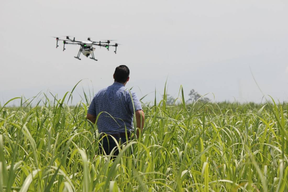
Modern agricultural enterprises can make use of machine vision for the targeted and location-specific cultivation of agricultural acreage (precision farming). The following scenario demonstrates how this works in practice: A drone fitted with a high-resolution camera flies over a piece of farmland. The integrated machine vision software evaluates the recorded images and automatically detects certain features from the air. For example, an abnormal chlorophyll content in the crops indicates a fungal disease or pest infestation. Based on these findings, farmers can take highly targeted measures. For example, they can precisely spray only the affected areas with pesticides or fungicides. Multispectral processes integrated into the machine vision systems help determine the condition of the plants. Special multispectral cameras are used to detect and process additional color channels that are invisible to the naked eye. This allows abnormalities in the vegetation to be detected automatically, reliably, and at an early stage.
Another application scenario is targeted fertilization. In this case, the machine vision software precisely measures the crop height based on the digital image data, making it possible to fertilize only low-growth areas as needed. The same principle can also be used to irrigate fields on a location-specific basis. In this case, infrared cameras measure the temperature and create a heatmap of the relevant area. On this basis, the measured evaporation chill can be used to precisely determine the actual degree of moisture in the individual regions, so that irrigation can be specifically adapted to requirements. The image data does not necessarily have to be recorded by drones but can also be captured by satellites from a great height.

Bu haberler ilginizi çekebilir

World Farmers Day 2026 Highlights the Importance of Sustainable Agriculture
Elicit Plant Names Boualem Saidi as EMEA Business Head
DEUTZ-FAHR Launches Series 8
DEUTZ-FAHR Powers BKT Euskadi Roadshow Across LALIGA Cities
AgroFresh opens new Asia Pacific R&D Center

Aylık Haber Bültenine Kaydolun

Gelişmeleri takip edin! Güncel haberleri doğrudan e-posta kutunuza alın.
Kaydolmakla, Kullanım Şartlarımızı kabul etmiş ve Gizlilik Politikamızda belirtilen veri uygulamalarını onaylamış olursunuz. İstediğiniz zaman aboneliğinizi iptal edebilirsiniz.
Bu Haberi Paylaşın
Facebook Bağlantıyı Kopyala Yazdır

Dergimiz Yayında

Okumak için Tıklayın
FacebookBeğen
InstagramTakip et
YouTubeAbone Ol
Türkiye’nin tarım ve teknoloji dünyasındaki sesi. Agroworld Dergisi, akıllı tarım uygulamalarından modern traktör teknolojilerine kadar geniş bir yelpazede güncel içerik, dijital dergi arşivi ve sektörel analizler sunarak geleceğin sürdürülebilir tarım dünyasına ışık tutmaktadır.
  • Künye
  • İletişim
  • Hakkımızda
  • Son Sayımız
  • Kullanım Koşulları
  • Reklam
  • Abonelik
  • Dergi arşivi
  • Fuar Takvimi
  • Gizlilik Politikası
banner
Tekrar hoşgeldiniz!

Hesabınıza giriş yapın

Kullanıcı Adı veya E-posta Adresi
Şifre

Şifrenizi mi unuttunuz?